This post is an experiment in customizing Google Maps with personal photos. I really wanted to use MapLib to create my own map that could then be embedded as a live image in the blog, but I'm having a little trouble figuring out just how to do that. The interface for "creating a map" is identical to Google's–in fact it is Google Maps–but when I save it and then go back to view my map, it's not there.
So, in the meantime, here is a link to a little map that I made in Google Maps, with a few photos taken at Elmwood Park. Click on the blue markers to see the photos.
Elmwood Park
The median strip that divides much of Main Street widens between Boughton Street and Elmwood Place, roughly centered around St. Peter Church. Today this is known as
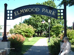 Elmwood Park, but back in the old days it was the Danbury Town Green. Today it's divided into two by Wooster Street, but I wonder if it didn't used to be one continuous strip of green, maybe with a bandstand where Wooster Street now divides it? The 9/11 memorial is located on the smaller strip, between the Fairfield County Courthouse on the east, and the Old Jail/Senior Center on the west. The larger strip has the fountain, and more shady seating, paths, and plantings. It's our own little oasis.